
Archives - Page 10
-
Excavation of a Bronze Age funerary site at Loth Road, Sanday, Orkney
Vol. 25 (2007)Excavation of a Bronze Age funerary site at Loth Road, Sanday, Orkney
Contributors: Diane Alldritt, Ann Clarke, Ann MacSween, Effie Photos-Jones, Julie Roberts
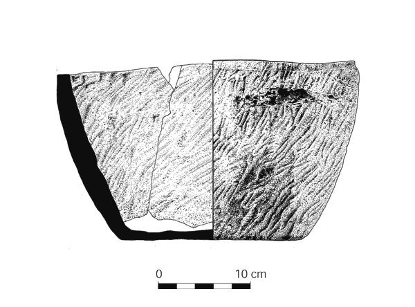
Summary: Excavations in 1991 beside Loth Road, Sanday (NGR: HY 60553 34489), revealed a funerary site, including two cists, which contained cremated human bone, and several pits. The cremation burial in one of the cists was contained in a soapstone vessel. These features presented evidence for the sorting, selection and differential deposition of pyre remains. The cists and pits were surmounted by a kerbed cairn of unusual construction. Radiocarbon dates from the pits placed the site in the Early to Middle Bronze Age.
Keywords: Cremation Burial, Kerbed Cairn, Funerary, Cremated Human Bone, Vessel, Pits
Period: Bronze Age
Location: Orkney Islands, Scotland, UK
-
Cist burials and an Iron Age settlement at Dryburn Bridge, Innerwick, East Lothian
Vol. 24 (2007)Cist burials and an Iron Age settlement at Dryburn Bridge, Innerwick, East Lothian
Contributors: Bill Finlayson, Hilary E M Cool, Trevor Cowie, Andrew Heald, Fraser Hunter, Dominic Ingemark, Mandy Jay, Julie Roberts, Alison Sheridan and Jennifer Thoms
Summary: This report provides an account of the excavations of a cropmark enclosure and other prehistoric remains at Dryburn Bridge, near Innerwick in East Lothian (NGR: NT 724 755). The excavations were directed over two seasons in 1978 and 1979 by Jon Triscott and David Pollock, and were funded by the Ancient Monuments Branch, Scottish Development Department. Features and artefacts of various periods were discovered during the excavations, including a Mesolithic chipped stone assemblage and pits associated with Impressed Ware pottery. A pair of distinctive burial cists dating to c 2300–2000 cal BC was discovered, each containing two inhumations, one articulated and the other disarticulated; a Beaker vessel was found directly above one of the cists. By the mid-1st millennium cal BC a settlement had been founded on the site. Three successive settlement layouts can be interpreted from the excavated structures. The first two phases represent continuous occupation, dating to before 400 cal BC, and consisted of timber roundhouses, other rectangular structures and a small cemetery of pit graves located within a palisaded enclosure. The final occupation phase, which extended into the Roman Iron Age and may have occurred after a break in occupation, consisted of an unenclosed settlement of ring-ditch houses.
Keywords: Pit Graves, Artefacts, Cemetery, Timber Roundhouses, Burial Cists, Chipped Stone, Palisaded Enclosure, Beaker Vessel, Settlement, Pottery, Pits, Burials
Periods: Iron Age, Roman, Mesolthic, Neolithic
Location: East Lothian, Scotland, UK
-
Excavations at Maybury Park, Edinburgh (1990–2)
Vol. 23 (2006)Excavations at Maybury Park, Edinburgh (1990–2)
Contributors: Daniel Johnson, Alan Saville, Alison Sheridan, Catherine McGill, Mhairi Hastie and Valerie Dean
Summary: This paper presents the results of a series of excavations carried out by the City of Edinburgh Council Archaeology Service between 1990 and 1992 in advance of the Edinburgh Park development (NGR: NT 178 720). Following a programme of test excavations, seven areas were opened up for excavation. Three of these contained significant archaeology dating to the Neolithic, Bronze and Iron Ages. The main findings included a Neolithic trackway, evidence for Bronze Age settlement and a large stone-built structure dating to the beginning of the 1st millennium AD.
Keywords: Trackway, Stonebuilt Structure, Settlement, Pit, Postholes, Ring Ditch
Periods: Neolithic, Bronze Age
Location: Edinburgh, Scotland, UK
-
Archaeological excavations in St Giles' Cathedral Edinburgh, 1981–93
Vol. 22 (2006)Archaeological excavations in St Giles' Cathedral Edinburgh, 1981–93
Contributors: David Henderson, Roderick P McCullagh, Derek Hall, George Haggarty, Julie Franklin, Thomas Addyman, Robin Murdoch and Pamela Graves
Summary: The report describes the results of excavations in 1981, ahead of development within the South Choir Aisle of St Giles' Cathedral (NGR: NT 25727 73590), and subsequent archaeological investigations within the kirk in the 1980s and 1990s. Three main phases of activity from the 12th to the mid-16th centuries were identified, with only limited evidence for the post-Reformation period. Fragmentary evidence of earlier structural remains was recorded below extensive landscaping of the natural steep slope, in the form of a substantial clay platform constructed for the 12th-century church. The remains of a substantial ditch in the upper surface of this platform are identified as the boundary ditch of the early ecclesiastical enclosure. A total of 113 in situ burials were excavated; the earliest of these formed part of the external graveyard around the early church. In the late 14th century the church was extended to the south and east over this graveyard, and further burials and structural evidence relating to the development of the kirk until the 16th century were excavated, including evidence for substantive reconstruction of the east end of the church in the mid-15th century. Evidence for medieval slat-bottomed coffins of pine and spruce was recovered, and two iron objects, which may be ferrules from pilgrims' staffs or batons, were found in 13th/14th-century burials.
Keywords: Boundary Ditch, Ditch, Ecclesiastical Enclosure, Iron, Graveyard, Pine, Church, Slatbottomed Coffins, Burials
Period: Medieval
Location: Edinburgh, Scotland, UK
-
Thainstone Business Park, Inverurie, Aberdeenshire
Vol. 21 (2006)Thainstone Business Park, Inverurie, Aberdeenshire
Contributors: Torben Bjarke Ballin, Andrew Heald and Fraser Hunter
Summary: Report on the excavation of a roundhouse and related structures at Thainstone Business Park, Inverurie, Aberdeenshire (NGR: NJ 773 181) dated by 14C to the 1st–2nd century AD. Internal details and building repairs allow some assessment of the structure of the building. The site also provides a well-dated context for a Guido class 13 glass bead, a type more common in isolated finds.
Keywords: Glass, Roundhouse, Hearths, Drainage System, Ploughing
Period: Roman
Location: Aberdeeshire, Scotland, UK
-
Cramond Roman fort: evidence from excavations at Cramond Kirk Hall, 1998 and 2001
Vol. 20 (2006)Cramond Roman Fort: evidence from excavations at Cramond Kirk Hall, 1998 and 2001
Contributors: Jeremy Evans, Mhairi Hastie, Fraser Hunter
Summary: Excavation on the site of an extension to Cramond Kirk Hall (NGR: NT 1907 7685) has provided new evidence for the layout of the defences of the Roman fort, the route of the road immediately beyond it and for the phases of Roman military occupation at Cramond postulated by previous excavators. The features encountered included a broad right-angled ditch, possibly part of the outer defences, turning at this point to run parallel with the road into the fort. Three much slighter parallel ditches or gullies at the south end of the site are tentatively identified as drainage features beside the Roman road which, on this interpretation, would lie just beyond the limit of excavation. At a later date, the ditch had been allowed to silt up and features including pits and a stone box-drain were cut on a different alignment, through the fill of the earlier ditch; a well was also cut across two of the roadside ditches. These later features appear to represent encroachment of extramural settlement on the defences during the Severan occupation, at a time when a large defended annexe had been constructed to the east of the fort.
Keywords: Ditch, Stone, Settlement, Gullies, Defences, Pits, Fort, Point
Period: Roman
Location: Edinburgh, Scotland, UK
-
Excavation of a Bronze Age wicker container, Gearraidh na h'Aibhne, Isle of Lewis
Vol. 19 (2006)Excavation of a Bronze Age wicker container, Gearraidh na h'Aibhne, Isle of Lewis
Contributors: Christopher Burgess, Mark Holmes, Jennifer Miller and Susan Ramsay
Summary: An archaeological excavation was carried out at Gearraidh na h'Aibhne near Calanais on the Isle of Lewis (NGR: NB 2333 3068) by Northamptonshire Archaeology, working for Glasgow University Archaeological Research Division (GUARD) as part of the Historic Scotland Human Remains Call Off Contract. The site, initially interpreted as a cist potentially containing a bog body, was identified during annual peat cutting. Excavation demonstrated that the feature was in fact an oval pit containing a quantity of hazel branches, capped with a number of flat slabs of Lewisian Gneiss. Several similar stones had been placed in the base of the feature, overlying more hazel branches.
Keywords: Radiocarbon, Wood Growthring Analysis, Sphagnum, Pit, Hazel, Bog Body, Hazel Pieces, Basket, Lewisian Gneiss
Period: Bronze Age
Location: Western Isles, Scotland, UK
-
The excavation of four caves in the Geodha Smoo near Durness, Sutherland
Vol. 18 (2005)The excavation of four caves in the Geodha Smoo near Durness, Sutherland
Contributors: D Alldritt, J H Barrett, E Photos-Jones, R Cerón-Cerrasco, C Smith, R Squair
Summary: In response to the threat posed by marine and river erosion, a series of deeply stratified midden deposits was excavated in caves leading off a narrow, rock-cut inlet known as the Geodha Smoo, near Durness, Sutherland. These included the famous Smoo Cave (NGR: NC 4136 6714), at the southern end of the inlet; two smaller caves cut into the western wall of the inlet (Glassknapper's Cave and Antler Cave); and a fourth cave (Wetweather Cave) in the eastern wall. The majority of excavated deposits from these caves appear to relate to Viking/Norse or post-Norse activity, with fish bones, marine shells and mammal and bird bones representing the processing and consumption of marine and terrestrial foods. Possible evidence for metalsmithing in the form of iron slag and boat nails could suggest that boats were repaired in the sheltered inlet. Four radiocarbon dates from Smoo Cave and Glassknapper's Cave provide evidence for use of these sites between the eighth and 11th centuries AD. Convincing evidence for pre-Norse activity, although unsupported by radiocarbon dates, was recovered from Glassknapper's Cave in the form of probable Iron Age pottery, while late Neolithic pottery came from floor deposits in the Wetweather Cave.
Keywords: Wall, Terrestrial, Floor, Pottery, Iron Slag, Fish Bones Marine Shells, Boat Nails, Midden, Radiocarbon Dates
Periods: Iron Age, Neolithic
Location: Highland, Scotland, UK
-
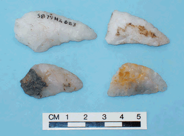
Re-examination of the quartz artefacts from Scord of Brouster: a lithic assemblage from Shetland and its Neolithic context
Vol. 17 (2005)Re-examination of the quartz artefacts from Scord of Brouster: a lithic assemblage from Shetland and its Neolithic context
Summary: In the late 1970s, a substantial quartz assemblage was recovered from the Neolithic settlement at Scord of Brouster, Shetland (NGR: HU 2560 5165). At the time, bipolar technique (which is responsible for a substantial proportion of the assemblage), as well as quartz technology in general, were poorly understood, and it was not possible to fully make use of the assemblage in the interpretation of the site, the region, or the period. With our expanded understanding of bipolar approaches and quartz technology, this is now possible, and, in the present paper, the assemblage is re-examined, re-classified and re-interpreted. The quartz assemblage is used to gain a deeper insight into the site itself, and its lithic component and a first sketch of the territorial structure of Neolithic Scotland is presented.
Keywords: Flakes Indeterminate Pieces Blades, Microblades Cores Tools, Debitage, Tools Arrowheads Knives Scrapers Piercers, Fabricator, Cores, Lithics
Period: Neolithic
Location: Shetland Islands, Scotland, UK
-
The excavation of a mound and three cist burials at Ferndall, Rendall, Orkney
Vol. 16 (2005)The excavation of a mound and three cist burials at Ferndall, Rendall, Orkney
Contributors: Gavin MacGregor, Tony Pollard, Jennifer Miller, Robert Will, Caitlin Evans, Susan Ramsey, Gillian McSwan, Jill Seivewright
Summary: As part of the Historic Scotland Human Remains Call Off Contract, Glasgow University Archaeological Research Division (GUARD) undertook an archaeological excavation of an artificial mound and associated cists containing human remains of mid-Bronze Age date, at Ferndale, Rendall, Orkney (NGR: HY 3836 2035). The excavation identified the presence of two cists containing cremation burials (cist 004 and cist 010), and a third that contained a poorly preserved inhumation (cist 003). Cists 004 and 010 would appear to be related to an artificially created mound, and parallel a number of similar 'barrow' sites from Orkney. Cist 004 contained an inhumation and was of differing construction. It would appear to relate to a different phase and tradition of cist burials. Analysis of skeletal material from cist 004 identified the remains of an older adult male, a female of between 18 and 30 years of age and an infant of 15 months. The adult male was found to have suffered from a bone infection of the femur and showed evidence of poor dental health. The female had suffered from iron deficiency anaemia. The preservation of skeletal material in cists 010 and 003 allowed only the identification of a single adult inhumation of unknown age and sex from each cist. The individuals from cists 004 and 010 had been cremated shortly after death, and analysis of associated soil residues suggests that their remains were subsequently picked from the pyre and washed. Radiocarbon dates from the cremated remains from cists 004 and 010 place the use of these two cists and construction of the associated mound in the first quarter of the second millennium BC. These dates are comparable to other dated cist burials in artificial mounds from Orkney, although it would appear to be one of the earlier sites in the currently available list of dates. Regrettably, a date could not be obtained from the poorly preserved inhumation from cist 003.
Keywords: Inhumation Cist, Mound, Cremation Burials Cist, Bone, Skeletal Material, Barrow, Excavation, Human Remains
Period: Bronze Age
Location: Orkney Islands, Scotland, UK

