
Archives - Page 8
-
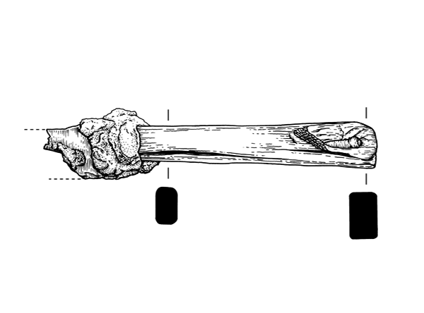
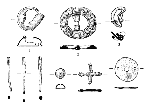
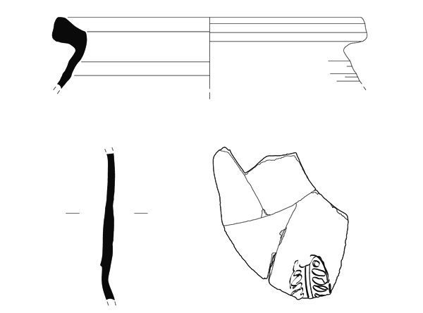
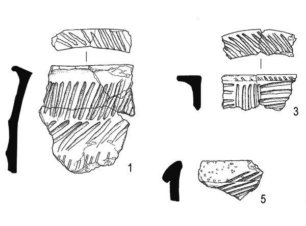
Late Neolithic and Late Bronze Age lithic assemblages associated with a cairn and other prehistoric features at Stoneyhill Farm, Longhaven, Peterhead, Aberdeenshire, 2002–03
Vol. 45 (2010)Late Neolithic and Late Bronze Age lithic assemblages associated with a cairn and other prehistoric features at Stoneyhill Farm, Longhaven, Peterhead, Aberdeenshire, 2002–03
Contributors: Michael Cressey, Mhairi Hastie, Adam Jackson, Melanie Johnson, Kevin Hicks, George Mudie and Leeanne Whitelaw
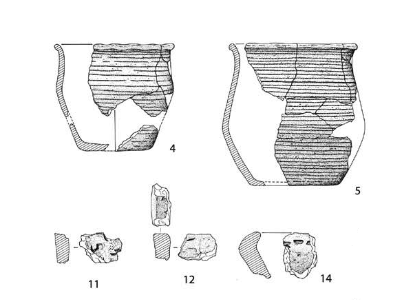
Summary: Prehistoric remains were recorded by CFA Archaeology Ltd (CFA) in 2002–03 during a programme of fieldwork at the landfill site within the boundaries of Stoneyhill Farm, which lies 7km to the southwest of Peterhead in Aberdeenshire (NGR: NK 078 409). These included a clearance cairn with a Late Bronze Age lithic assemblage and a burial cairn, with Late Neolithic and Early Bronze Age lithics and Beaker ceramics. Other lithic scatters of similar date had no certain associations, although pits containing near-contemporary Impressed Wares were nearby. Additional lithic assemblages included material dated to the Mesolithic and Early Neolithic. What may be proto-Unstan Wares in an isolated pit were associated with radiocarbon dates (barley) of the first half of the 4th millennium BC. These findings represent a substantial addition to the local area's archaeological record and form an important contribution to the understanding of lithic technology and ceramics in earlier prehistoric Scotland.
Keywords: Radiocarbon Dates Barley, Pit, Pits, Lithic, Beaker Ceramics, Fieldwork, Ceramics, Lithic Scatters, Burial Cairn, Lithics, Cairn
Periods: Late Neolithic, Earlier Prehistoric, Late Bronze Age, Early Neolithic, Prehistoric, Early Bronze Age, Mesolithic, Prehistoric
Location: Aberdeenshire, Scotland, UK
This paper is dedicated to the memory of Ian Shepherd, whose site visits enlightened this and other projects undertaken by Ian Suddaby.
-
Excavations on the route of the Dalkeith Northern Bypass, 1994–95 and 2006
Vol. 44 (2010)Excavations on the route of the Dalkeith Northern Bypass, 1994–95 and 2006
Contributors: Derek Alexander, Torben Bjarke Ballin, David Caldwell, Ciara Clarke, Bill Finlayson, Adam Jackson, Melanie Johnson, Fraser Hunter, Robert McCulloch, Fay Oliver, Ruth Pelling, Jennifer Thoms, Felicity Wild
Summary: An evaluation and subsequent targeted excavations were carried out along the route of the proposed A68 Dalkeith Northern Bypass by the Centre for Field Archaeology (CFA) between September 1994 and March 1995, with additional watching briefs taking place in 1997. The bypass was not constructed at the time, and further pre-construction mitigation work was recommended in 2005, with fieldwork being carried out in 2006–08. This report describes the results of the evaluations and each excavation individually. The route traverses a narrow strip of the Lothian plain which contained several prehistoric sites, including two ring-groove structures, a stone-paved area and two pit alignments, a Roman temporary camp, a post-medieval building, an 18th-century designed landscape, and two industrial sites (a brick and tile works and a coal pit engine house). Several sites also produced ephemeral remains of earlier or later date. Overall, the results indicated a settlement pattern and land use which concentrated on the sands and gravels of the river terraces, with far less settlement on the unforgiving compacted clays which otherwise characterise large parts of the road corridor.
Keywords: Postmedieval Building, Brick, Corridor, Tile, Pit, Coal Pit Engine House, Settlement Pattern
Periods: Roman, Prehistoric
Location: Midlothian, Scotland, UK
-
The excavation of Bronze Age roundhouses at Oldmeldrum, Aberdeenshire
Vol. 43 (2010)The excavation of Bronze Age roundhouses at Oldmeldrum, Aberdeenshire
Contributors: Torben Bjarke Ballin, Mhairi Hastie, Melanie Johnson, Dawn McLaren, Jennifer Thoms, Adam Jackson and Michael Cressey
Summary: Excavations in summer 2005 to the north of Oldmeldrum, Aberdeenshire (NGR: NJ 806 279), revealed the remains of at least three Bronze Age ring-ditch roundhouses and associated features, together apparently forming elements of an area of open settlement. The excavations were conducted in advance of the construction of a new bypass road around the north of Oldmeldrum, related to new housing development.
Keywords: ring-ditch, roundhouse, settlement
Period: Bronze Age
Location: Aderdeeshire, Scotland, UK
-
Through the Cowgate: life in 15th-century Edinburgh as revealed by excavations at St Patrick's Church
Vol. 42 (2010)Through the Cowgate: life in 15th-century Edinburgh as revealed by excavations at St Patrick's Church
Contributors: Anne Crone, Morag Cross, Julie Franklin, Sarah-Jane Haston, N M McQ Holmes, Stephen Lancaster, T M Mighall, Eileen Reilly, Clare Thomas, Scott Timpany, Auli Tourunen
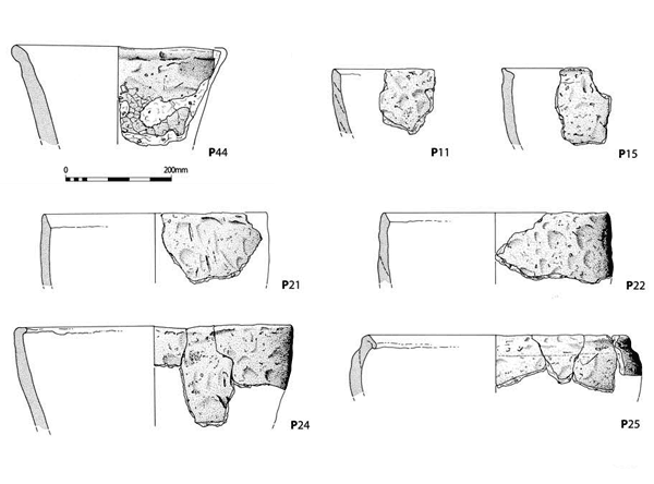
Summary: Excavations in the grounds of St Patrick's Church, Edinburgh (NGR: NT 26123 73610) were undertaken by Headland Archaeology from November 2006 to February 2007 on behalf of the Archdiocese of St Andrews and Edinburgh in advance of the construction of a hotel on the site. Soil analyses suggested that flash floods had swept through this part of Cowgate up until the early development of the medieval town upslope in the 11th–12th centuries. This early pattern was followed by the gradual build-up of material washed downslope from the High Street; this contained midden material and dung beetles, illustrating the nearby presence of the town. The site lay outwith the bounds of the burgh until the 14th century, when a substantial ditch was cut across the site, believed to be the medieval town boundary. The ditch was backfilled in the 15th century and finds and samples have revealed a vivid picture of life in the medieval town. The ditch was a stinking rubbish dump for many kinds of human and animal detritus, which illustrates that the Cowgate was a busy thoroughfare to the town's markets and contained a variety of industries, including horn working. After the ditch was filled in deep midden deposits, characteristic of this area of Edinburgh, built up on the site.
Keywords: cattle, comb, bones, beads, midden, arable, clay, copper, stoneware,
Periods: medieval, 15th century
Location: Edinburgh, Scotland, UK
-
Excavations on the site of Balmerino House, Constitution Street, Leith
Vol. 41 (2010)Excavations on the Site of Balmerino House, Constitution Street, Leith
Contributors: Sue Anderson, Dennis Gallagher, George Haggarty, Derek Hall, Andrew Heald, Adam Jackson, Dawn McLaren and Catherine Smith
Summary: The remains of the front of Balmerino House (NGR: NT 2711 7616), built in 1631, were uncovered during an archaeological excavation at St Mary's Star of the Sea Roman Catholic Church, Constitution Street, Leith. The work also revealed several phases of medieval to post-medieval activity, and a small burial ground which predated the house. The earliest feature uncovered by the excavation was a well containing 13th- to 14th-century pottery. Large quantities of late to post-medieval pottery were recovered, as well as iron objects, glass and bone. The human remains comprised six adult males, although some were incomplete due to later disturbance. Of importance to the history of clay tobacco pipe manufacture in Scotland is a small assemblage of clay-pipe wasters and kiln waste dated c 1630–40.
Keywords: Clay Tobacco Pipe Manufacture, Bone, Burial, Iron Objects Glass, Pottery, Human Remains, Catholic Church
Periods: Medieval, Roman
Location: Edinburgh, Scotland, UK
-
Artefactual, environmental and archaeological evidence from the Holyrood Parliament Site excavations
Vol. 40 (2010)Artefactual, environmental and archaeological evidence from the Holyrood Parliament Site excavations
Summary: The site of the new Scottish Parliament in Edinburgh (NGR: NT 26702 73840) was the focus of archaeological work that illuminated medieval Canongate and unravelled the history of Queensberry House. It appears that the site was the location for prehistoric human activity, perhaps from the earliest period of habitation in Scotland. The material from the main excavation encompasses a broad date range, mainly reflecting the site’s occupation from the medieval period until recent times, although a lithic assemblage of prehistoric date was also present. The finds from the Queensberry House excavation provide additional insights, particularly into the later periods of activity on the site. The environmental evidence comprised carbonised plant remains, animal and fish bone, and soils and sediments.
Keywords: Ash, Coal Ash, Midden, Scottish Parliament, Queensberry House
Periods: Medieval, Prehistoric, Bronze Age, Mesolithic
Location: Edinburgh, Scotland, UK
-
The excavation of an Early Bronze Age burnt mound at Arisaig, Lochaber, Highland
Vol. 39 (2009)The excavation of an Early Bronze Age burnt mound at Arisaig, Lochaber, Highland
Contributors: Torben Bjarke Ballin, Michael Cressey, Clare Ellis, Karen Clarke and Leeanne Whitelaw
Summary: During the upgrading of the A830(T), the 'Road to the Isles', the remains of a disturbed burnt mound deposit were discovered and later excavated during September and October 2005 by CFA Archaeology Ltd. This is the first such feature to have been excavated in this part of the Highlands. The burnt mound was discovered lying partly below a modern field bank on the edge of Arisaig (NGR: NM 6667 8650) during a trial trenching evaluation. Excavation demonstrated that the feature was formed in an active fluvial environment and that, despite the rural and boggy location, it had suffered considerable damage since its formation, caused by both the fluvial action of the adjacent stream and by a field drain. No evidence was found for either a hearth or a formal trough. The implication of a small assemblage of local quartz from within the burnt material is discussed. The charcoal assemblage is compared to spectra of pollen from contemporary deposits of peat in the area. Studies of the nature and origin of the burnt material via the results of soil magnetic susceptibility and thin-section analyses are presented. Six radiocarbon dates from three associated contexts span the period from 2550 to 1900 BC and suggest the burnt mound accumulated during the Early Bronze Age.
Keywords: Burnt Mound, Charcoal, Hearth, Pollen, Trial Trenching Evaluation, Field Drain, Radiocarbon Dates, Field Bank, Mound
Period: Early Bronze Age
Location: Highland, Scotland, UK
-
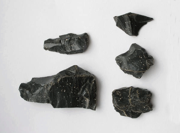
Gazetteer of Arran pitchstone sources: presentation of exposed pitchstone dykes and sills across the Isle of Arran, and discussion of the archaeological relevance of these outcrops
Vol. 38 (2009)Gazetteer of Arran pitchstone sources: presentation of exposed pitchstone dykes and sills across the Isle of Arran, and discussion of the archaeological relevance of these outcrops
Summary: The main element of the present paper is a gazetteer of exposed pitchstone sources across the Isle of Arran. In the paper's final chapter, the archaeological relevance of these outcrops is discussed. The gazetteer includes approximately 100 pitchstone sources, and the authors hope that it will become a useful tool to prehistorians working on and outwith Arran, thus adding to our understanding of how pitchstone was perceived, exchanged and used in northern Britain. In general terms, the gazetteer should provide a more rigorous basis for archaeological and geological assessment of pitchstone artefacts and sources.
Keyword: pitchstone
Period: medieval
Location: North Ayrshire, Scotland, UK
-
The archaeology of the streets of North Berwick and implications for the development of the burgh
Vol. 37 (2009)The archaeology of the streets of North Berwick and implications for the development of the burgh
Contributor: Julie Franklin
Summary: Replacement and upgrading of the mains water system in North Berwick provided an opportunity to identify and record deposits and structures across the core of the medieval burgh. The methods of trench excavation used meant that archaeological features were largely only seen in section, however, a large amount of information about the development of the burgh, and its layout, was collected despite this. Over much of the central core of the medieval burgh, layer upon layer of occupation deposits and more mixed material were interspersed with obvious inundations of wind-blown sand. The existence of a rough surface running east-west along much of the High Street could suggest that this is the more likely candidate for the earliest focus for the burgh, rather than the north/south running Quality Street further to the east. Road surfaces were also seen along East Road, running out of the town. The density of occupation deposits markedly lessened along Westgate, the continuation of the High Street, indicating the limits of the medieval core. A number of structures were also identified, including a wall at the east of the town that may represent the town wall, or at least define the limit of settlement to the east. The data collected from the watching brief will allow better assessments for future planning decisions, and also shows the importance of archaeological monitoring of this type of construction work.
Keywords: Settlement, Wall, Watching Brief
Periods: Medieval, Post-medieval
Location: East Lothian, Scotland, UK
-
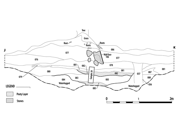
The Severe Terrain Archaeological Campaign: investigation of stack sites of the Isle of Lewis 2003–2005
Vol. 36 (2009)The Severe Terrain Archaeological Campaign: investigation of stack sites of the Isle of Lewis 2003–2005
Contributors: Ann MacSween, Jo McKenzie, Susan Ramsay and Catherine Smith
Editor: Beverley Ballin Smith
Summary: The STAC (Severe Terrain Archaeological Campaign) project conducted topographic and archaeological surveys of sea stacks and other cliff-bound coastal sites around the Isle of Lewis over three annual field seasons from 2003–2005. The project made use of a specialised access system called 'Industrial Rope Access', which proved to be both a safe and a practical way of achieving archaeological research in such places. The first part of this report details the formation and methods of the STAC project, and discusses some relevant geographical issues. The second part presents the results of the eleven site surveys. One of these sites, Dunasbroc, was thought to be particularly vulnerable to erosion and was subject to small-scale excavation, the results of which form the third part of the report.
Keywords: coastal erosion, Brunary Burn Structures, Blockhouse, Walls, Drystone Rectangular Wall, STAC
Period: Neolithic
Location: Western Isles, Scotland, UK

