
Our publications
Vol. 97 (2021): Prehistoric communities of the River Dee: Mesolithic and other lithic scatter sites of central Deeside, Aberdeenshire
Prehistoric communities of the River Dee: Mesolithic and other lithic scatter sites of central Deeside, Aberdeenshire
Author: Caroline Wickham-Jones
Contributors: Richard Bates, Alison Cameron, Ann Clarke, Diane Collinson, Sheila Duthie, Tim Kinnaird, Gordon Noble, Irvine Ross, Heather Sabnis and Richard Tipping
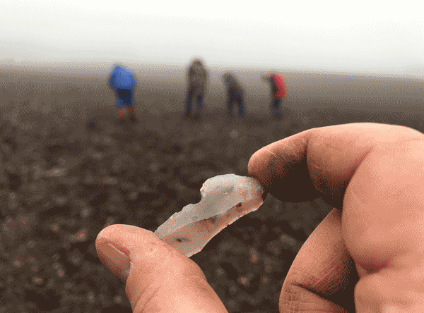
Summary: This volume presents the results of archaeological fieldwork undertaken along the River Dee, Aberdeenshire, north-east Scotland, by the Mesolithic Deeside voluntary community archaeology group between 2017 and 2019. A total of 42 fields were investigated, from which over 11,000 lithics were recovered, representing at least 15 archaeological sites and a span of human activity covering some 10,000 years from around 12,000 BC to c 2000 BC. Finds from the Late Upper Palaeolithic, Mesolithic, Neolithic and Bronze Age were present. Work comprised fieldwalking, test pitting, specialist analysis, and small-scale excavation. The investigation described here is significant not just for the light it throws on the early prehistoric populations along the River Dee but also for the methodology by which investigation was undertaken, as this provides a potential model for work in other areas. Both aspects are covered in the report.
The River Dee flows between postglacial gravel and sand terraces, the structure of which has played an important role for the early settlers of the area, and this is covered in some detail in order to provide the physical background framework for the sites. There are also sections on more specialised geophysical and geoscience techniques where these were undertaken, together with a summary of research on the palaeoenvironmental conditions throughout the millennia of prehistory. The artefactual evidence comprises lithic assemblages which were all catalogued as fieldwork progressed; the contents of each site are presented, together with more detailed analysis of the finds from test pitted sites. Finally, given the rich archaeological record from the area, the results of the present project are set into the wider context of the evidence for prehistoric settlement along the river, and there is consideration of future directions for further fieldwork.
While all authors have contributed to the whole volume, individual sections that present specialist work by specific teams have been attributed. The distribution maps and GIS are the work of Irvine Ross.
Dates given are calibrated BC dates. The Nethermills Farm NM4 dates are calibrated using the Oxford Radiocarbon Accelerator Unit calibration program OxCal 4 (Bronk Ramsey 2009) and their date ranges are calibrated using the IntCal13 atmospheric calibration curve (Reimer et al 2013). Optically stimulated luminescence (OSL) was used to profile sediment accumulations on some of the sites and obtain information relating to site formation, but it was not used for dating in any of the projects.
Locations: Aberdeenshire, Scotland, UK
Periods: Late Upper Palaeolithic, Mesolithic, Neolithic, Bronze Age
Keywords: lithic scatter, fieldwalking, stone tool, community archaeology

This work is licensed under a Creative Commons Attribution-NonCommercial 4.0 International Licence.
Published:
09-11-2021
